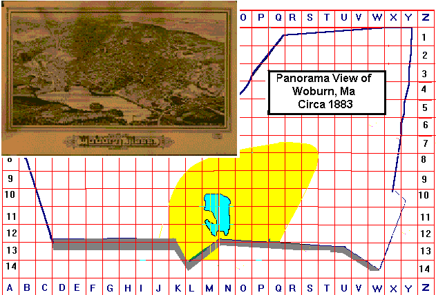
1883 Panorama Mural Map by Burleigh
LARGE PANORAMIC VIEW of WOBURN in 1883
SHADED AREA IS LAND MASS COVERED BY THIS MAP
This mural map which is drawn as a bird's eye fly over is also in the Library of Congress. If you magnify this map you will also see vehicles and people going about their daily lives. The land area covered is bounded in the south by the town line with Winchester; in the north by the Lowell St Wyman St interection; in the east as far as Vernon St; and in the west as far as the Lexington and Pleasant St intersection.
If you wish to find a specific address CLICK HERE to View the Street Index for this map